
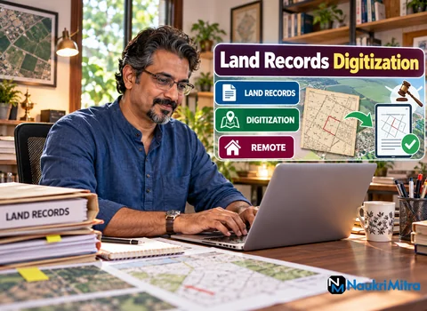
The sheet arrives as a 400 dpi scan of a village map drawn by hand some sixty years ago, cloth-backed, folded twice, with a tea stain across the north-east corner. The plot lines were inked, but the survey numbers were pencilled in and have faded to a grey whisper. Turning that sheet into clean, accurate layers in QGIS is the daily business of online land records digitization jobs, and it rewards patience far more than speed. The hours are part-time, the desk is your own, applications are accepted from every country, and the work is paid at $15 per hour (USD).
In plain terms, you take paper land records and make them usable on a screen without changing a single fact. The last step, and the one that matters most, is checking what you built against the original paper.
A land records digitization job description usually splits into four parts: imaging, georeferencing, digitising and data entry, with verification running through all of them. You do not interpret anything. If a deed and a map disagree, you record the disagreement and flag it. Opinions on who owns a plot, or on any dispute, are never part of the role.
Old documents are fragile, so scanning settings are decided before anything touches the glass. Typical project rules ask for 300 dpi for typed deeds and 400 to 600 dpi for maps, saved as lossless TIFF rather than JPEG, with a ruler in frame. Scanning software such as NAPS2, VueScan or the scanner maker's own utility is common; what matters is consistent settings and no automatic "enhancement" that could erase a faint pencil mark.
A scan is only an image until it knows where it sits. In QGIS you open the Georeferencer from the Layer menu, load the scan, and place ground control points: a road junction, a canal culvert, the corner of a temple tank, each matched to the same feature on a reference layer the project supplies. You choose a transformation (often linear or first-order polynomial for a fairly true sheet, thin plate spline for a warped one), set the target coordinate reference system the project specifies, and check the residual error for each point before saving a GeoTIFF.
Back to that faded village sheet. Twelve control points spread around the edges gave a tidy fit everywhere except the south, where the paper had stretched along a fold. Two points there showed large residuals. Rather than forcing the fit, the technician removed one suspect point, added two better ones along a surveyed road, and wrote the final error in the batch log so a reviewer could see exactly what was done.
With the scan in place, you create a polygon layer, usually in a GeoPackage, and trace each plot. Snapping keeps neighbours sharing one edge, and the Topology Checker plugin catches overlaps and gaps. Each polygon gets its attributes: survey or khasra number, village code, sheet number and any remark.
Survey numbers are stored as text, never as numbers, because "214/1A" and "0214" must survive exactly as written. On the village sheet, one faded label could have read 214/1 or 214/7. The correct move was to enter it as uncertain, attach a zoomed crop of the scan, and leave the decision to the supervising office.
Deeds and registers are copied character for character: owner names in their recorded spelling, father's or husband's name where the format requires it, area in the unit used on the document (acres, hectares, bighas or guntha, depending on the state), and dates as shown. You do not modernise spellings or convert units unless the project asks for a separate converted field. Reading Devanagari, Tamil, Telugu or another regional script is a real advantage.
Every record is confidential. Names, plot numbers and scans stay inside the approved system, never in personal email, chat apps or public cloud folders.
Verification is where careful people stand out. A sound routine compares the count of plots on paper with polygons on screen, reads back every survey number against the scan, checks that areas calculated in QGIS are roughly consistent with recorded areas (a large mismatch is flagged, not "corrected"), and confirms that adjoining sheets meet without gaps. Your notes on each issue are as valuable as the polygons.
QGIS is free and runs on Windows, macOS and Linux, but large rasters need a reasonable machine: a recent multi-core processor, 8 GB of RAM at minimum (16 GB is more comfortable), an SSD, and a monitor large enough to see fine linework, ideally with a second screen for the scan beside the map. Stable broadband matters because GeoTIFFs are heavy to upload and download.
Files follow the project's naming pattern, something like district_village_sheet_v03.tif, with version numbers rather than "final" or "new". Work in the cloud storage or server folder the project provides and never keep copies on a shared family computer.
Most land records digitization work from home is organised in batches. A coordinator assigns a set of sheets or registers with a deadline, often a week or two away. You might georeference early in the week, trace over several sittings, then check and submit with a log. A reviewer returns comments: a missed subdivision, a boundary drawn to the wrong side of a road. You fix them and resubmit. Hours depend on the batches available, so part time land records digitization jobs vary week to week and nothing here promises a fixed amount.
A degree in geography, civil engineering or a related subject is preferred but not required, and basic QGIS knowledge is a strong advantage. You need to handle scanning software, read maps and deeds closely, and type accurately. For land records digitization jobs for freshers, the honest route is skill proof. Download a public domain historical map, georeference it, digitise a dozen parcels and write a one-page log of your control points and errors.
A land records digitization course is not mandatory. The free QGIS training manual and the many open tutorials on georeferencing cover the core. Short certificates in GIS from universities or recognised training bodies help on a land records digitization resume, but a clear sample with a written method often counts for more. List the land records digitization skills you can show: CRS handling, Georeferencer, snapping and topology, attribute tables, regional scripts and typing speed with accuracy.
Part-time work on this vacancy is paid $15 per hour (USD). The usual land records digitization salary per hour elsewhere differs by employer, country and contract; any extra incentive would be the employer's choice and is not part of this offer.
In India, much of this work traces back to the Digital India Land Records Modernization Programme, under which states digitise registers and cadastral maps, along with the SVAMITVA scheme that maps village inhabited areas with drones and the ULPIN, a unique ID for each land parcel. State revenue departments, survey offices and the GIS service firms they contract all need digitisers. Freelance land records digitization jobs also come from mapping and archive projects abroad.
General GIS data entry often means adding attributes to features someone else drew. This role goes further back: from paper to georeferenced raster to vector, with exact transcription. Demand looks steady, since old sheets are still being scanned and every parcel ID needs a clean boundary. Growth leads to quality reviewer, GIS analyst or field survey support roles.
No genuine digitisation project takes money from you. Say no to a "registration fee", a paid "software kit" or a QGIS "licence" (QGIS is free to download), to "typing jobs" that hold a deposit, to an unpaid trial that is secretly a whole district's batch, to anyone wanting a bank OTP or UPI PIN, to "HR" who lives only on WhatsApp, and to task apps that pay a little before asking you to "invest".
Applications cost nothing. Include a covering note, your resume, and a link or attachment showing a georeferenced map with a few traced parcels and your error log. Mention which scripts you read and how many hours a week you can usually offer.