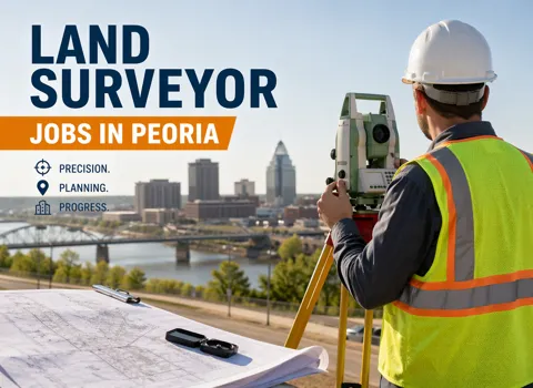
Land Surveyor Opportunity – Peoria
Position Snapshot
Before a single foundation is poured in Peoria, someone has already traced the land's contours with care. That early work doesn’t draw attention, but it quietly determines whether everything that follows goes smoothly. This position sits right at that starting point.
As a Land Surveyor, the job is part fieldcraft, part technical thinking. Some days are spent outdoors, reading the land as it is. Other days are spent turning that information into something engineers and builders can actually use. This role offers an annual salary of $65,000, paired with steady, hands-on work that directly connects to real projects across the area.
Why This Role Matters
A project can look perfect on paper and still run into trouble if the ground reality doesn’t match. That’s where this work makes a difference.
Clear, accurate survey data keeps construction aligned from the start. It helps avoid boundary disputes, reduces rework, and gives engineering teams confidence that their plans will hold up once they hit the site. Even small corrections made early can save weeks of delays later.
It’s practical, grounded work—but the ripple effect is huge across timelines, budgets, and overall build quality.
What Your Typical Day Looks Like
The day might begin on-site, sometimes early, when the area is still quiet. Equipment gets set up—GPS units, a total station—and reference points are marked across the terrain. The conditions vary. Some sites are flat and straightforward; others require navigating slopes, obstacles, or partially cleared land.
After gathering measurements, the pace shifts. Back at a workstation, those numbers need to be checked, organized, and translated. CAD software comes into play here, turning field data into clear maps and layouts that others can follow.
There’s also regular back-and-forth with engineers or site leads. A marking might need adjustment. A measurement might need confirmation. The work moves in cycles—collect, review, refine—until everything lines up with confidence.
What Helps You Succeed Here
Being comfortable with surveying equipment is a given, but the real difference comes from how you use it. GPS systems, total stations, and leveling tools all require a steady hand and good judgment in the field.
On the technical side, a working knowledge of CAD software is important, since most outputs are digital plans. Understanding how land features—like slope and elevation—affect construction is just as valuable.
Attention to detail matters more than speed. Catching a small inconsistency early is often what keeps a project on track. Clear communication also plays a role, especially when explaining findings to people who rely on your data but weren’t there to collect it.
How This Role Operates in Practice
The work doesn’t stay in one place for long. Some days are fully outdoors, while others lean more toward analysis and documentation. Weather, project phase, and site readiness all influence how the day unfolds.
There’s a steady connection to other teams. Survey results move quickly into engineering plans and construction layouts, so accuracy and timing both matter. It’s independent work at times, but never isolated—your output is always part of a larger workflow.
Tools That Make the Work Possible
The job relies on a mix of dependable field tools and digital systems.
GPS surveying equipment helps map positions across larger areas. Total stations handle more detailed measurements where precision really counts. Leveling tools support elevation work, especially when grading or drainage is involved.
Once the data is collected, CAD software is used to build out site plans and drawings. In some cases, GIS tools help layer that data with broader geographic context. Together, these tools turn field observations into something practical and usable.
A Real Example from This Role
On one site in Peoria, a survey was underway before a new commercial build. Everything looked routine at first. But while checking the measurements, one section didn’t quite match the records for the property.
Instead of pushing forward, the area was rechecked using both GPS and total station readings. The mismatch turned out to be real. It was small, but enough to affect where the building would sit.
The updated boundary was documented and shared with the engineering team. Plans were adjusted before any excavation began. What could have become a legal issue later was resolved quietly in the early stages.
That’s often how the work plays out—small corrections that prevent larger problems.
Who This Role Fits Best
This role tends to suit people who don’t mind switching between outdoor conditions and focused technical work. It’s a good fit for someone who prefers steady, methodical tasks over rushed environments.
People who do well here usually notice details others miss and take the time to verify their work. There’s also a practical mindset involved—understanding that the numbers collected in the field have real consequences once construction begins.
It helps to be comfortable working both independently and alongside teams who depend on your input.
Closing Note
Land surveying isn’t always visible, but it’s always present at the start of a project. The accuracy of that first step carries through everything that follows.
For someone who values careful work, clear outcomes, and a direct link to real-world projects, this role offers a steady and meaningful path. Every site you step onto becomes part of something larger, taking shape—and your work helps ensure it starts the right way.